The Monarch’s Way
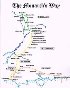
The Monarch’s Way is probably less well known than the Cotswold Way despite being between 615 and 625 miles long, making it the longest inland trail route in England.
It runs all the way from Worcester via Bristol and Yeovil to Shoreham in West Sussex.
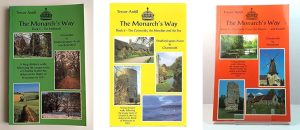
The route was established in 1994 by Trevor Antill and loosely follows the escape route taken by King Charles II after he was defeated in the Battle of Worcester in 1651.
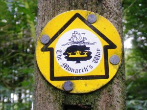
As well as the standard sign posts it is also marked by a waymarker using a logo with a drawing of the ship’ Surprise’ above a Prince of Wales three-point feathered crown on a silhouette of the Royal Oak tree at Boscobel House in Shropshire. Allegedly the King hid in the oak tree all day and in Boscobel House overnight and the ship ‘Surprise’ allowed him to escape from England to France.
When walking in the Cotswolds you’ll come across many Monarch’s Way waymarkers where the two routes cross paths.
Many of our hikes cross over with Monarch’s Way so get in touch now if you fancy following in the footsteps of history.