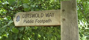
The Cotswold Way FAQs
The Cotswold Way – answering some commonly asked questions:
How fit do I need to be to walk on The Cotswold Way route? Most people with an average level of fitness can walk on The Cotswold Way route. There are no mountains to climb & the highest point is Cleeve Hill at 314 meters. The landscape is one of rolling hills so you will be doing regular small climbs and descents. If you are unsure then it is always best to consult your local doctor. It is also worth doing a few walks closer to home to see how you get on and build up your fitness if you are worried how you will get on.
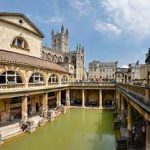
How long is the route?102 miles, most people walk from North to South starting at Chipping Campden and finishing at Bath.
How many days should I take to complete the route? We have had customers walk the route in 5 days and others take 15 days, it is up to you and how much time you have available. Most of our customers walk the route over 7 or 8 walking days averaging 12 – 14 miles per day.
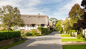
What is the accommodation like? Some of the bigger towns have a wide variety of accommodation, in more remote places there may only be one or two options. We know the available accommodation on the route and use a selection of Inns Guesthouses and small hotels to give our guests the best possible experiences. All rooms will come with ensuite or private bathroom facilities and full English breakfasts are provided the next day.
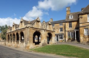
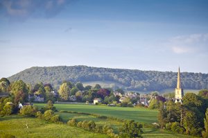
Does the route get busy?The Cotswold Way route never gets busy with long lines of walkers. You will most likely see some other walkers on the route every day in season. During the high season, May to September,accommodation gets booked up quickly with tourists. It is therefore advisable to arrange your trip well in advance. The Cotswolds are the second most visited place in the UK after London. The vast majority of people come to see the ‘picture postcard’ towns and villages. Only a small fraction of people walk and see the real beauty of The Cotswold region.
How do I get to the start and from the finish? The Route does not have easy transport links; cars can be left at Chipping Campden. The nearest train station is Moreton in Marsh, 5 miles away. Local buses and taxis can transfer you there. Bath has its own train station and buses run regularly to London. We can offer you advice on what is best to suit your situation.
What will the weather be like?In a word, ‘unpredictable’, we have no control over English weather! The driest months, with least chance of rain, are July and August. Our favorite months to walk are May and September. It is always best to pack some light waterproof clothing, just in case.
Here is the link to our Cotswold Way page
We wish you happy hiking….